European Arctic maps win 2006 British Cartographic Society Awards
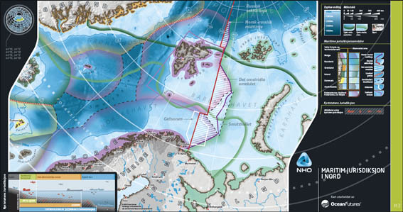
Map 3: Maritime jurisdiction in the European Arctic
Innovative maps of the European Arctic developed by Ocean Futures (Norway), UnParalleled (USA), the Confederation of Norwegian Enterprise (Næringslivets Hovedorganisasjon (NHO)), and Environmental Research & Assessment scooped top honours at the internationally prestigious 2006 British Cartographic Society Awards, held in Manchester on 9 September 2006. Illustrated at left, Map 3 in the series of eight portrays the complex mosaic of maritime jurisdiction in the European Arctic (click to download a pdf version (1.3 MB)).
The map series won first prize in the Electronic Maps category, then went head-to-head with the winners in the other categories to be judged by the BCS as overall Best Mapping Entry 2006. The standard of entries was extremely high, with leading map-makers such as National Geographic, HarperCollins Publishers, and GeoInnovations winning awards in other categories.
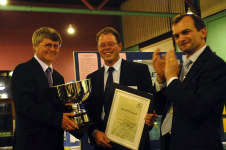
Jan Magne Markussen (left) and Colin Harris (centre) receive the BCS Award from the (then) President of the British Cartographic Society Seppe Cassettari. Photo: © Martin Lubikowski 2006
ERA's role was to construct a GIS database and basic maps from information researched by Ocean Futures. The maps were then exported for graphic design specialists UnParalled (USA) to work their magic. The series of eight maps were then customised by NHO using Adobe Macromedia Flash for presentation on the NHO website.
Dr Jan Magne Markussen, Director of Ocean Futures, accepted the awards for Ocean Futures and on behalf of the team. Credits for the award-winning maps are as follows: Authors: Steven Sawhill and Johan Kvarving Vik (Ocean Futures, Norway); GIS: Colin Harris and Fiona Danks (ERA, UK); Graphic design: Roger Sawhill (UnParalleled, USA); Flash design: Egil Tvilde (NHO, Norway); Published by: Ocean Futures and Næringslivets Hovedorganisasjon, Oslo, Norway; Copyright: © 2006 Ocean Futures.
Antarctic Peninsula Wildlife Awareness Map Series
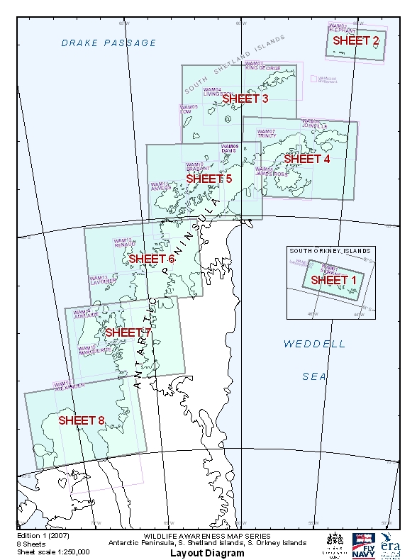
Wildlife Awareness Map Series index; © ERA 2007
Following publication in 2006 of the Wildlife Awareness Manual (WAM): Antarctic Peninsula, South Shetland Islands, South Orkney Islands, in November 2007 ERA produced a series of 8 large-format 1:250,000 maps based on the WAM. The maps were commissioned by the Polar Regions Unit of the UK Foreign & Commonwealth Office to help support pre-flight planning on HMS Endurance. The maps were designed to assist helicopter pilots to avoid concentrations of wildlife when conducting operations in the region.
ERA's new logo and website
The Arctic tern seemed the perfect symbol for ERA given our current mix of work spanning both poles and West Africa. Designed by Roger Sawhill, Director of US graphic design company Unparalleled, the Arctic tern is the only bird to migrate between the poles, and does so mostly via the western coasts of Europe and Africa! While we have no wish to emulate the Arctic tern's phenomenal annual migrations, we clearly share a love of the polar regions and surely a passion for the world's geography! With our new logo taking flight, the time seemed right to launch ERA's new website. We are very grateful to Jeremy Barker, who kindly assisted us by writing the code to implement the new website design.
Second Edition of Southern Ocean Cruising published
The launch of the Second Edition of Sally and Jérôme Poncet's Southern Ocean Cruising took place on 7 November 2007 in Cambridge at the offices of the UNEP World Conservation Monitoring Centre. Generously supported by the Polar Regions Unit of the UK Foreign & Commonwealth Office, the new edition fully updates information on the special conservation provisions that apply in Antarctica and on the sub-Antarctic islands. The revisions were undertaken by Sally Poncet, Susie Grant and Colin Harris, working in cooperation with a wide range of organisations and specialists. The stunning cover photograph is by award-winning photographer Ben Osborne (winner of Shell Wildlife Photographer of the Year 2007), while a delightful sketch of the threatened albatross by Ellen MacArthur on the title page reminds us both of the beauty and of the fragility of this region. The revised edition is supported by a new set of maps, and contains a wealth of useful information for anyone planning a visit South. Obtain the publication from ERA.
