Services

Environmental mapping & information

  • Geographic Information Systems (GIS) & remote sensing
  • Digital mapping, orthophotography, decision support systems & databases
  • Global Positioning Systems (GPS) surveys
  • Internet interfaces to environmental information

Capabilities

GIS and digital mapping comprise an essential part of ERA's work portfolio. Extensive experience in this field enables the company to offer a comprehensive service in the production, analysis and presentation of map data.

For specialist remote sensing and photogrammetry, ERA uses Leica Photogrammetry Suite™, which includes Imagine Advantage™ - highly capable software for satellite image analysis and for the production of digital orthophotography. We also have extensive experience in the use of GPS for accurate field surveys.

ERA has the capability of producing maps in a wide variety of digital and hardcopy forms according to client needs.
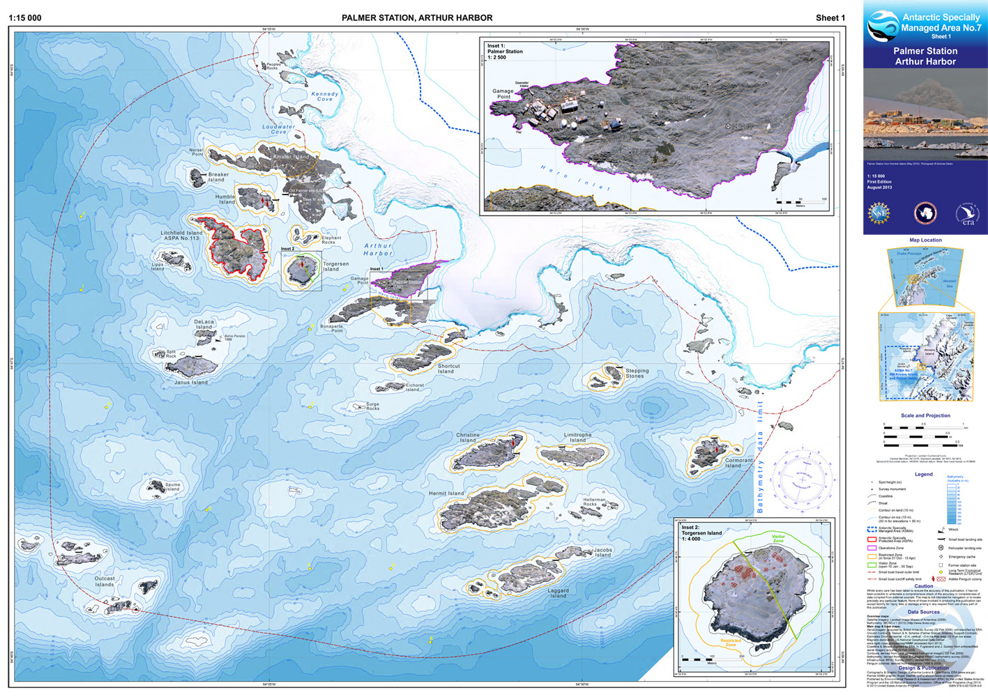
 Of particular note, ERA recently took delivery of the latest Hewlett Packard DesignJet™ Z3100PS large-format printer, which is an outstanding postscript machine suited to map, graphics and photo reproduction. The Z3100PS is one of the most sophisticated large-format devices on the market, and is capable of producing photo-quality output up to 1118 mm (44") in width, or A0 size, and up to a theoretical length of 90 m! ERA has a close working relationship with the Technical Design Team of HP Europe in The Netherlands, and worked closely with them beta-testing this model prior to its official release and taking delivery of the production machine. ERA's feedback was used to help fine-tune the product and iron-out pre-production issues.

A major advantage of the HP Z-Series printers lies in their ink technology, with print longevity assessed as >200 years under museum conditions. Anyone with experience of older large-format printers will know that prints would sometimes fade within a matter of weeks! The Z3100PS has overcome this problem, and offers stable and rich colours for more than a lifetime! A further advantage is the huge range of media that can be used, including glossy papers, film, canvas etc. A built-in scanning colorimeter enables accurate profiling of media and colours to ensure faithful and consistent reproduction of final output. ERA can offer clients the benefits of this highly sophisticated technology at a surprisingly reasonable cost, so if it seems of interest please feel free to get in touch to discuss your requirements.


Example of map prepared for the US Antarctic Program: Palmer Station, Anvers Island, Antarctic Peninsula.


Firefox 2
Design: ERA; Construction: Jeremy Barker (www.jerbarker.co.uk) & ERA
© Environmental Research & Assessment (ERA) Ltd.
Last Update: 23 July 2011